

How a Land Surveyor Helps Acreage Buyers in Tuscaloosa, Alabama
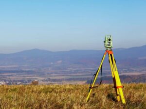
Rural land deeds can be vague in ways that surprise buyers. Some describe corners by old trees, fence posts, or creeks that moved years ago. Others list an acreage number that nobody has checked in decades. When you’re paying by the acre, those gaps can cost you real money.
A land surveyor checks what you’re buying before the money changes hands. They confirm the lines, the size, the access, and the shape of the land. The best time to call one is right after your offer is accepted, while you still have time to act on what the survey shows.
What Acreage Buyers Need to Verify Before Closing
Acreage buyers should confirm four things before closing. They are the true boundary lines, the real size of the tract, legal access, and any recorded rights that affect the land. A land surveyor can check each of these through record research and fieldwork. Your title company and lawyer handle the legal side, but the survey gives them facts to work with.
Size matters more than many buyers expect. A listing may say 40 acres, but the survey could find 37 or 42. If the price is based on acreage, even a small difference can change what you should pay. Some contracts allow the price to adjust based on the survey, so ask your agent or lawyer how yours is written.
Check your timeline too. Large tracts take longer to survey than a city lot. Order the survey early so it’s done well before your closing date.
How Survey Research Clarifies Large Property Boundaries
Survey research means digging through deeds, plats, and older records to learn how the land was described over time. Many rural deeds use metes and bounds. That’s a way of describing land by directions and distances from one corner to the next. Old descriptions may point to things like a stump, a stone pile, or the center of a creek.
The land surveyor compares those records with what’s on the ground. They search for monuments, which are markers like iron pins, concrete posts, or old stones set at corners. When markers are missing, the surveyor uses evidence and records to decide where the corner belongs. Then they set new markers so you can find your lines later.
Don’t Trust Fences on Rural Land
Fences on farmland and timber land often follow the easiest path, not the legal line. Some were built to hold cattle, and others went around trees or ditches. A fence can sit many feet inside or outside the true boundary. The survey shows where the lines really are, and it can point out fences, sheds, or roads that cross them.
Checking Access and Recorded Rights Across Rural Acreage
Legal access means you have a recorded right to reach your land from a public road. Some tracts touch a public road directly. Others rely on a private drive, a farm path, or an easement across a neighbor’s land. A path you can drive on today isn’t always a path you have a legal right to use.
A land surveyor can show recorded access easements on the survey when the title documents are provided. They can also show where the road or drive actually runs on the ground. Sometimes the traveled path doesn’t match the recorded easement. That kind of mismatch is much easier to fix before you close than after.
Other recorded rights can affect rural land too. These may include power lines, gas pipelines, drainage ditches, or shared driveways. Some limit where you can build, clear trees, or dig. Your lawyer should review any recorded right that could affect how you plan to use the property.
Evaluating Terrain for Future Land Improvements
Terrain is the shape of the land, including hills, low spots, creeks, and slopes. If you plan to build a home, barn, pond, or driveway, the terrain will shape where those can go. A topographic survey maps the rises and dips of the ground with contour lines. It helps you see which parts of the tract are good for building and which are not.
Water deserves a close look. Low areas, creeks, and wet spots can flood or stay soggy after heavy rain. A land surveyor can show how the tract relates to flood zones on federal flood maps. Some buyers also order an elevation certificate if they plan to build near a flood area, since insurance and lender needs vary.
Other checks may be needed for your plans. A home site without public sewer may need a soil test for a septic system. That test is done by a separate professional, but the survey helps them find the right spot. Ask your surveyor which details will help your builder or engineer most.
Using Survey Findings to Guide Acreage Purchase Decisions
A survey gives you facts you can act on before closing. If the acreage comes in short, you may be able to adjust the price. If a neighbor’s barn sits over the line, your lawyer can help work out a solution. If access is missing, you’ll know to fix it or walk away.
Title insurance is another reason the survey matters. Many title policies list survey issues as exceptions unless a current survey is provided. A new survey may help your title company offer broader coverage, though this varies by company and policy. Ask your title agent what they need.
Share the survey with your agent, lawyer, and lender as soon as it’s ready. Each of them may see something that affects the deal. Clear facts lead to better choices and fewer surprises after you own the land.
Frequently Asked Questions
Do I need a survey to buy acreage?
A survey isn’t always required, but it’s one of the best ways to protect yourself. Some lenders and title companies ask for one, and rules vary by lender and property type. Without a survey, you’re trusting old records and fence lines. That’s a big risk on a large purchase.
How long does an acreage survey take?
Timing depends on the size of the tract, the terrain, and how much record research is needed. Thick woods, creeks, and missing corners can slow fieldwork. Ask for an estimated schedule when you request a price. Order early so the survey is done before your closing date.
What if the acreage is different from the listing?
It’s common for the survey to show a slightly different number than the listing. Older deeds often used less precise methods. If your price is based on acreage, talk with your agent or lawyer about whether it can be adjusted. The survey gives you the facts you need for that talk.
Can a land surveyor tell me if the land is landlocked?
A surveyor can show whether the tract touches a public road and where recorded easements fall. They can also show where existing drives run on the ground. Your lawyer and title company confirm whether your legal access is valid. Together, they can help you understand your access before closing.
Will the survey show if the land floods?
A surveyor can show how the tract relates to flood zones on federal flood maps. A topographic survey can also show low spots and drainage paths. These tools help you see where water may collect. For insurance or building plans, ask whether you’ll also need an elevation certificate.